
This project is implemented by Aria Technologies, a French company specialized in computation of pollutant dispersion, meteorological analysis, wind, emission, and air quality modeling and ACR, the Associação Catarinense de Empresas Florestais. The project aims to implement a Fire Risk Management tool for ACR associates.
Brazil ended 2017 with a record number of burnings since 1999. Some 272 thousand fire outbreaks were recorded, 46% more than in the previous year. The fire increased in areas of natural forest, advancing in places where there was no record of flames, and reaching protected areas and indigenous lands.
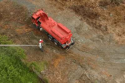
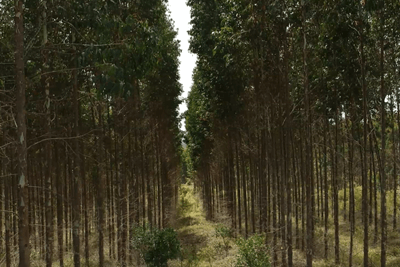
Forest owners and different sectors in the Brazilian Agribusiness are impacted by fires over states such Parana, São Paulo, Minas Gerais and Espirito Santo. The energy sector has a similar demand, to protect Power Lines, and avoid supply disruption. The Forest Sector in Brazil needs to build capacity and reinforce their forest fire prevention and mitigation actions. ACR and its associates are in high need of applying same methodologies applied in Europe and United States.
The ARIA FIRESC system is based on the application of the FARSITE4 and FLAMMAP models, used to evaluate fire evolution and fire risk mapping in Portugal, Spain and North America. Those algorithms represent fire behavior considering a multifactor risk condition: meteorology, topography and vegetation fuel properties.
ARIA FIRESC is a pioneer initiative to implement fire behavior models for operational use in Brazil, coupled with the automatic hot spot detection by satellite/cameras.
The project is divided in two phases. The first phase will be the development of a DEMO version for approximately 12.000 hectares. The second phase will to scale the system to the full area of interest, integrating it with ACR fire management tools as well as consolidating web service.
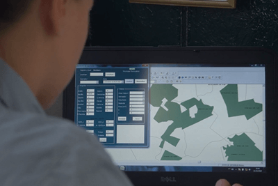
A DEMO of Aria Firesc will be first implemented which will be a web-based system which integrates two forecast modules. The first one a risk assessment based on a fire behavior model considering not only the impact of meteorological conditions but also to compute the effect of topography, land use and vegetation fuel properties. And the second one, a Fire spread forecast based on weather forecast with simulate the fire spread patterns the next 6 hours; the simulation can be processed automatically from by satellites/towers detection or on demand.